Bitterhand (talk | contribs) No edit summary Tag: Visual edit |
Bitterhand (talk | contribs) No edit summary Tag: Visual edit |
||
| Line 1: | Line 1: | ||
| − | [[File:Map of the Shire from lord of the rings.PNG|thumb|300px| |
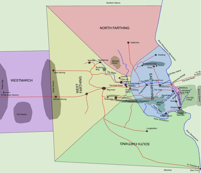
+ | [[File:Map of the Shire from lord of the rings.PNG|thumb|300px|As seen on this map of the [[Shire]]]] |
'''Standelf''' was a village in the south of [[Buckland]]. |
'''Standelf''' was a village in the south of [[Buckland]]. |
||
| − | It was located about five miles south of [[Bucklebury]] and a couple miles north of [[Haysend]] next to the [[High Hay]]. |
+ | It was located about five miles south of [[Bucklebury]] and a couple miles north of [[Haysend]] next to the [[High Hay]].<ref>[[The Lord of the Rings|''The Lord of the Rings'']], ''[[The Fellowship of the Ring]]'', "A Part of the Shire" map</ref> |
| − | |||
| − | It was founded sometime after [[TA 2340]]. |
||
== References == |
== References == |
||
| ⚫ | |||
| − | * [[The Complete Guide to Middle-earth]] |
||
| − | * [[The Atlas of Middle-earth]] pg. 71 |
||
| − | |||
| ⚫ | |||
[[nl:Staandelf]] |
[[nl:Staandelf]] |
||
Revision as of 13:20, 26 October 2019
As seen on this map of the Shire
Standelf was a village in the south of Buckland.
It was located about five miles south of Bucklebury and a couple miles north of Haysend next to the High Hay.[1]
References
- ↑ The Lord of the Rings, The Fellowship of the Ring, "A Part of the Shire" map