(Italian translation from the map of the italian edition of Lotr.) Tag: Visual edit |
Tag: Visual edit |
||
| Line 55: | Line 55: | ||
|Russian |
|Russian |
||
|Мичел Делвинг |
|Мичел Делвинг |
||
| + | |- |
||
| + | |Slovenian |
||
| + | |Velko Prekopansko |
||
|- |
|- |
||
|Spanish (Spain and Latin America) |
|Spanish (Spain and Latin America) |
||
Revision as of 10:47, 10 January 2018
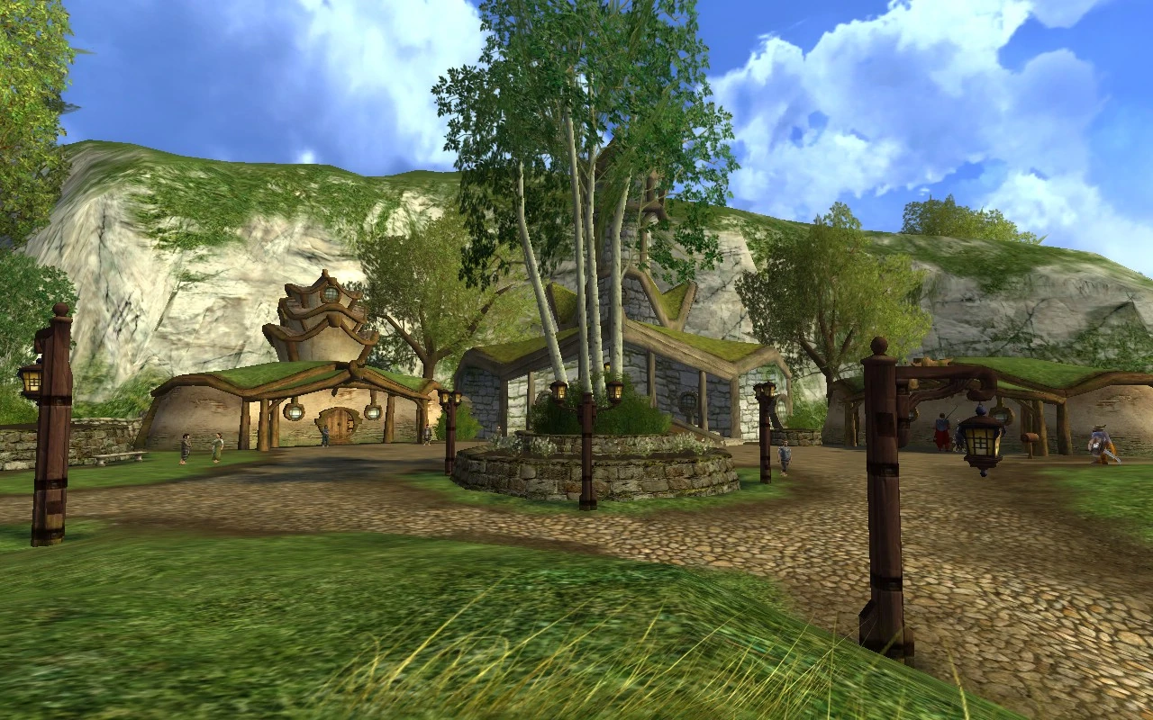
Michel Delving in The Lord of the Rings Online
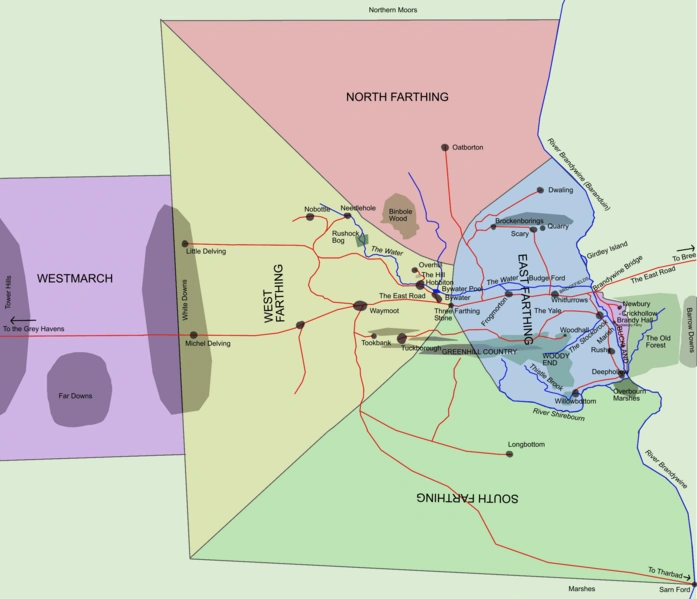
Michel Delving is in the Westfarthing of the Shire.
Michel Delving is the largest town in the Shire, located in the western edge of the Westfarthing in the White Downs on the Great East Road. The Mayor of the Shire is elected in Michel Delving, which is also the location of the Lockholes and the famous Mathom-house.[1]
Translations around the World
| Foreign Language | Translated name |
|---|---|
| Arabic | ميشيل الخوض |
| Catalan | Miquel Escarball |
| Dutch | Grotedelft |
| Finnish | Järin Möyremä |
| French | Grandcave |
| German | Michelbinge |
| Hebrew | מישל דלבינג |
| Hungarian | Nagyüreg |
| Italian | Pietra Forata |
| Macedonian | Мишел нурнати |
| Norwegian | Mikkelskløft Miklabol |
| Persian | میشل تعمق ? |
| Portuguese (Brazil) | Grã Cava |
| Portuguese (Portugal) | Michel Delving |
| Russian | Мичел Делвинг |
| Slovenian | Velko Prekopansko |
| Spanish (Spain and Latin America) | Cavada Grande |
| Swedish | Fylke |
| Tamil | மைக்கேல் மூழ்குவது |
| Turkish | Ulığ Kazın |
| Yiddish | מיטשעל דעלווינג |
Appearances
References
- ↑ The Atlas of Middle-earth, Regional Maps, "The Shire"
Template:Space