Hyperephania (talk | contribs) Tag: Visual edit |
DarkLantern (talk | contribs) (updated formatting & updated) |
||
| (One intermediate revision by one other user not shown) | |||
| Line 1: | Line 1: | ||
| − | {{Location infobox |
+ | {{NeedsReferences}}{{Location infobox |
|name= Harad |
|name= Harad |
||
|image=Harad.jpeg |
|image=Harad.jpeg |
||
| Line 19: | Line 19: | ||
== Geography == |
== Geography == |
||
| − | Harad lies between the sea of [[Umbar]] to its |
+ | Harad lies between the sea of [[Umbar]] to its west, and [[Khand]] to its northeast, and was divided into two main provinces: [[Near Harad]], which was the closest to both Mordor and Gondor, and [[Far Harad]], nearest to the land of Umbar. [[Harondor]], otherwise known as [[South Gondor]], was a buffer zone in the very north of Harad between the lush, verdant grasslands on the Gondor side of the [[Anduin]] and the inhospitable dunes of sand to the far south, and was contested over by Gondor and Harad. The river [[Poros]] formed Harondor's northern border, while the river [[Harnen]] formed its southern border. Its climate was most likely a semi-arid grassland but presumably more fertile than Harad. Its boundaries extended roughly from the Anduin to the western flank of [[Mordor]] and stopped around an imaginary line protruding horizontally from the bay of [[Umbar]]. On the northeast it was bordered by the [[Mountains of Shadow]], and it ran west to the [[Bay of Belfalas]]. |
| − | The boundary between Near Harad and Khand is not described, and it is unclear how far east Near Harad extended. The majority of Near Harad is desert, described by [[Gollum]] as where the "[[Sun|yellow face]] is bright and terrible". In the southeast of Near Harad, a natural gulf fed far into the landmass, and a large river flowed inland from there to the northwest, later forking. One branch of the river flowed westwards towards [[Umbar]], and the other northeast. Neither the gulf nor the rivers were given names by Tolkien. |
+ | The boundary between Near Harad and Khand is not described, and it is unclear how far east Near Harad extended. The majority of Near Harad is desert, described by [[Gollum]] as where the "[[Sun|yellow face]] is bright and terrible". In the southeast of Near Harad, a natural gulf fed far into the landmass, and a large river flowed inland from there to the northwest, later forking. One branch of the river flowed westwards towards [[Umbar]], and the other northeast. Neither the gulf nor the rivers were given names by Tolkien. |
The boundary between Near and Far Harad is indistinct, but compared to the other regions Far Harad was immense, covering all the territory relatively equivalent to [[wikipedia:Africa|Africa]]. Far Harad was large enough that it most likely had an extremely varied climate. Much of the southern extents of Far Harad were covered in forests and jungle. The great [[Mûmakil]], called Oliphaunts in legend by the [[Hobbits]], were native to this area. The Mûmakil were rarely seen outside of Far Harad after the [[Third Age]]. |
The boundary between Near and Far Harad is indistinct, but compared to the other regions Far Harad was immense, covering all the territory relatively equivalent to [[wikipedia:Africa|Africa]]. Far Harad was large enough that it most likely had an extremely varied climate. Much of the southern extents of Far Harad were covered in forests and jungle. The great [[Mûmakil]], called Oliphaunts in legend by the [[Hobbits]], were native to this area. The Mûmakil were rarely seen outside of Far Harad after the [[Third Age]]. |
||
| Line 35: | Line 35: | ||
=== Second Age === |
=== Second Age === |
||
| − | After the [[First Age]], the men of these lands were among the lesser men who were instructed by the voyaging [[Númenóreans]] in the basic arts of civilization. This went on for some time until the middle of the Second Age when the Númenóreans turned their backs on wisdom and became their overlords. |
+ | After the [[First Age]], the men of these lands were among the lesser men who were instructed by the voyaging [[Númenóreans]] in the basic arts of civilization. This went on for some time until the middle of the Second Age when the Númenóreans turned their backs on wisdom and became their overlords. |
From the latter part of the [[Second Age]], many of the Men of Harad were dominated by the Númenóreans, as were many other peoples whose lands included a coastline. Shortly before the [[War of the Last Alliance]], two Númenórean lords, named [[Herumor]] and [[Fuinur]], "rose to great power amongst the Haradrim", but their ultimate fate is not recorded. |
From the latter part of the [[Second Age]], many of the Men of Harad were dominated by the Númenóreans, as were many other peoples whose lands included a coastline. Shortly before the [[War of the Last Alliance]], two Númenórean lords, named [[Herumor]] and [[Fuinur]], "rose to great power amongst the Haradrim", but their ultimate fate is not recorded. |
||
| Line 62: | Line 62: | ||
* [[Easterlings]] |
* [[Easterlings]] |
||
| − | == |
+ | ==Translations== |
<div style="overflow:auto; height:300px; width:500px; float:left"> |
<div style="overflow:auto; height:300px; width:500px; float:left"> |
||
<!--<div style="overflow:auto; height:200px;">--> |
<!--<div style="overflow:auto; height:200px;">--> |
||
| Line 95: | Line 95: | ||
|Gujarati |
|Gujarati |
||
|હરાદ |
|હરાદ |
||
| + | |- |
||
| + | |Hebrew |
||
| + | |האראד |
||
|- |
|- |
||
|Hindi |
|Hindi |
||
Revision as of 04:21, 19 January 2020
|
"Can you see anything?" "Nothing. There's nothing." The descriptive majority of this article's text is unsourced, and should be supported with references. |
Harad, fully named Haradwaith, was the immense realm located south of both Gondor and Mordor. The Men of Harad were known as Southrons or Haradrim ("South-multitude").
Geography
Harad lies between the sea of Umbar to its west, and Khand to its northeast, and was divided into two main provinces: Near Harad, which was the closest to both Mordor and Gondor, and Far Harad, nearest to the land of Umbar. Harondor, otherwise known as South Gondor, was a buffer zone in the very north of Harad between the lush, verdant grasslands on the Gondor side of the Anduin and the inhospitable dunes of sand to the far south, and was contested over by Gondor and Harad. The river Poros formed Harondor's northern border, while the river Harnen formed its southern border. Its climate was most likely a semi-arid grassland but presumably more fertile than Harad. Its boundaries extended roughly from the Anduin to the western flank of Mordor and stopped around an imaginary line protruding horizontally from the bay of Umbar. On the northeast it was bordered by the Mountains of Shadow, and it ran west to the Bay of Belfalas.
The boundary between Near Harad and Khand is not described, and it is unclear how far east Near Harad extended. The majority of Near Harad is desert, described by Gollum as where the "yellow face is bright and terrible". In the southeast of Near Harad, a natural gulf fed far into the landmass, and a large river flowed inland from there to the northwest, later forking. One branch of the river flowed westwards towards Umbar, and the other northeast. Neither the gulf nor the rivers were given names by Tolkien.
The boundary between Near and Far Harad is indistinct, but compared to the other regions Far Harad was immense, covering all the territory relatively equivalent to Africa. Far Harad was large enough that it most likely had an extremely varied climate. Much of the southern extents of Far Harad were covered in forests and jungle. The great Mûmakil, called Oliphaunts in legend by the Hobbits, were native to this area. The Mûmakil were rarely seen outside of Far Harad after the Third Age.
People
- Main article: Haradrim
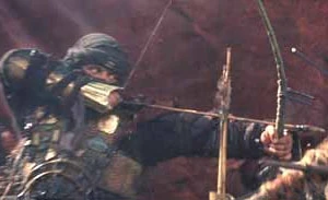
An archer of Harad
Harad's tribes were divided (at least in the minds of the men of northwestern Middle-earth) into those of Near and Far Harad, although there were many tribes of the Haradrim, often mutually hostile. Those of Near Harad were swarthy, with black hair and dark eyes, whereas the people of Far Harad had black skin.
History
Second Age
After the First Age, the men of these lands were among the lesser men who were instructed by the voyaging Númenóreans in the basic arts of civilization. This went on for some time until the middle of the Second Age when the Númenóreans turned their backs on wisdom and became their overlords.
From the latter part of the Second Age, many of the Men of Harad were dominated by the Númenóreans, as were many other peoples whose lands included a coastline. Shortly before the War of the Last Alliance, two Númenórean lords, named Herumor and Fuinur, "rose to great power amongst the Haradrim", but their ultimate fate is not recorded.
Third Age
For many centuries of the Third Age, many Haradrim were still ruled by Black Númenórean Lords and ultimately, the Harad fell under the influence of Mordor for much of the Age.
Much of Far Harad was a jungle, although there also was a desert. In Far Harad lived the great beasts known as Mûmakil or Oliphaunts native to Far Harad used by the Haradrim as moving war towers.
Near Harad later formed an alliance or maybe even a coalition of some sort with the Corsairs of Umbar, and was involved in a series of continual battles with Gondor over South Gondor or Harondor. Anciently its northern border was held to be the river Harnen, but by the time of the War of the Ring all the land south of the river Poros was under the influence of the Haradrim.
Fourth Age
After the revival of the Reunited Kingdom of Gondor and Arnor in the Fourth Age, many of the Haradrim were pardoned and allowed to live in peace. They were required to relinquish South Gondor and Umbar, but remained a free people.
Etymology
In Sindarin, Harad means "South".[1] In Quenya, it was Hyarmen.
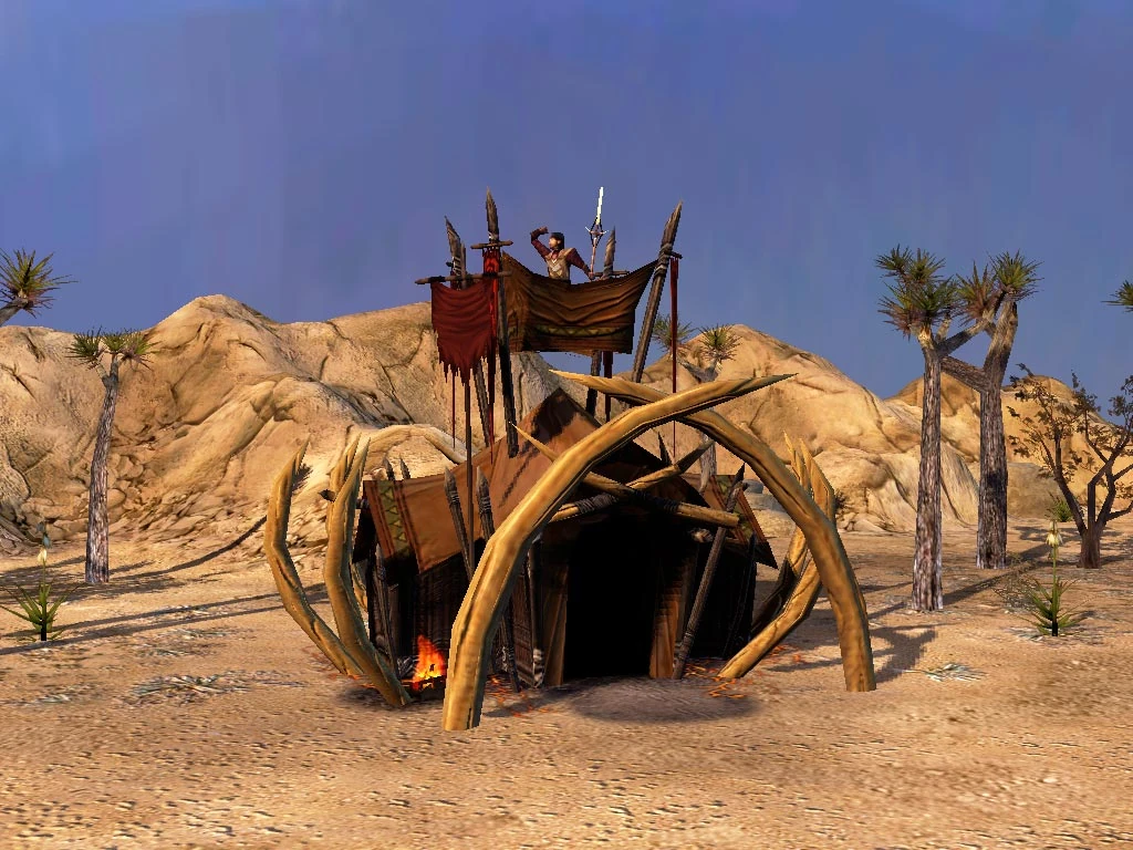
A "Haradrim Palace" in the BFME games
Portrayal in adaptations
- In The Lord of the Rings: The Battle for Middle-earth II, warriors from Harad are prominently featured.
- Harad and its surroundings are depicted in The Lord of the RIngs Minecraft mod. The region is significantly fleshed out with original content.
See Also
Translations
| Foreign Language | Translated name |
| Amharic | ሃራድ |
| Arabic | هاراد |
| Belarusian Cyrillic | Харад |
| Bengali | হার্ড |
| Bulgarian Cyrillic | Харад |
| Chinese | 哈拉德 |
| Chinese (Hong Kong) | 哈化德林 , or simply translated to 哈德 |
| Georgian | ჰარადი |
| Gujarati | હરાદ |
| Hebrew | האראד |
| Hindi | हरद |
| Japanese | ハラド |
| Kannada | ಹರಾದ್ |
| Kazakh Cyrillic | Харад |
| Korean | 하라ᄃ |
| Kyrgyz Cyrillic | Hарад |
| Macedonian Cyrillic | Харад |
| Malayalam | ഹരദ് |
| Marathi | हरद |
| Mongolian Cyrillic | Харад |
| Nepalese | हरद |
| Pashto | هاراد |
| Persian | هاراد |
| Punjabi | ਹਰਡ |
| Russian | Харад |
| Serbian | Харад (Cyrillic) Harad (Latin) |
| Sindhi | هاري |
| Sinhalese | හරද් |
| Tajik Cyrillic | Харад |
| Tamil | ஹரத் |
| Telugu | హరద |
| Thai | ฮารัด |
| Ukrainian Cyrillic | Гарад |
| Urdu | حرض |
| Uzbek | Ҳарад (Cyrillic) Harad (Latin) |
| Yiddish | חאַראַד |
| Amon Ereb • Forest of Brethil • Dor-lómin • Eriador • Estolad • Ladros | |
| Arnor • Dunland • Gondor • Haradwaith • Númenor • Rhûn • Umbar | |
| Arnor (later split into Arthedain, Cardolan, and Rhudaur) • Rohan • Dale • Dunland • Lake-town (later part of the kingdom of Dale) • Gondor • Haradwaith • Khand • Rhovanion • Rhûn • Umbar • Vales of Anduin | |
| Dale • Haradwaith • Núrn • Reunited Kingdom of Gondor and Arnor • Rohan • Rhûn • Khand • Eriador • Vales of Anduin | |
|
Places of Middle-earth and Arda
Middle-earth Locations:
Provinces/Regions: Arnor | Dunland | Ettenmoors | Forochel | Forodwaith | Gondor | Harad | Ithilien | Khand | Lindon | Minhiriath | Mordor | Rhovanion | Rhûn | Rivendell | Rohan | The Shire Forests & Mountains: Amon Dîn | Amon Hen | Amon Lhaw | Caradhras | Emyn Muil | Erebor | Fangorn Forest | High Pass | Iron Hills | Lórien | Mirkwood | Mount Doom | Mount Gundabad | Old Forest | Orod-na-Thôn | Tower Hills | Weathertop Hill City/Fortifications: Angband | Barad-dûr | Bree | Caras Galadhon | Dol Guldur | Fornost Erain | Hornburg | Isengard | Minas Morgul | Minas Tirith | Last Homely House | Tower of Amon Sûl | Tower of Orthanc | Osgiliath | Umbar | Utumno Miscellaneous: Argonath | Astulat | Buckland | Cair Andros | Dagorlad | Dead Marshes | Enedwaith | Fords of Isen | Gap of Rohan | Grey Havens The rest of Arda:
Aman | Burnt Land of the Sun | Dark Land | Empty Lands | Neldoreth | New lands | Númenor | Tol Eressëa |
References
- ↑ Parma Eldalamberon, Words, Phrases and Passages in Various Tongues in The Lord of the Rings by J.R.R. Tolkien